 |
Astronomical Orientation of CastellieriFriuli - Italy |
|
|
Astronomical Orientation of CastellieriFriuli - Italy |
|
|
|
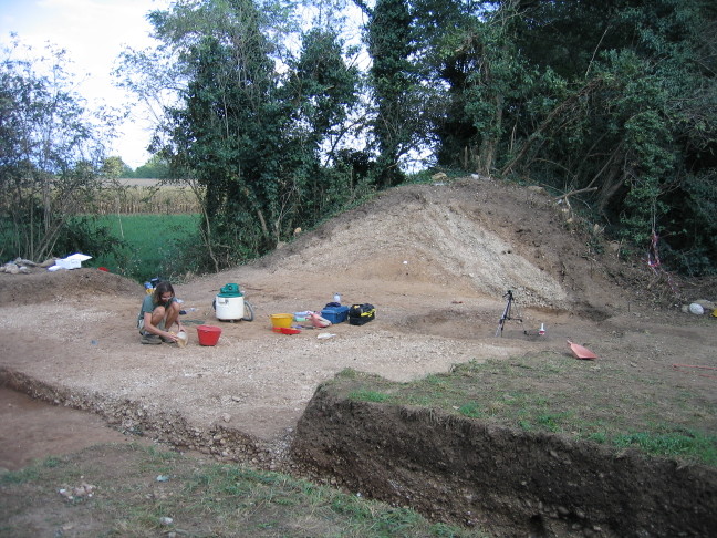
| Archaeological dig by the University of Udine - Galleriano (August 2007). Well visible is the cross section of the perimetrical castelliere embankment. | The SW embankment of the castelliere in Galleriano (photos by the author). |
|
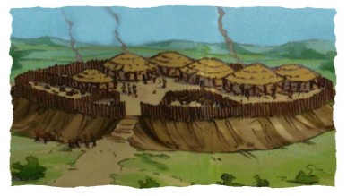
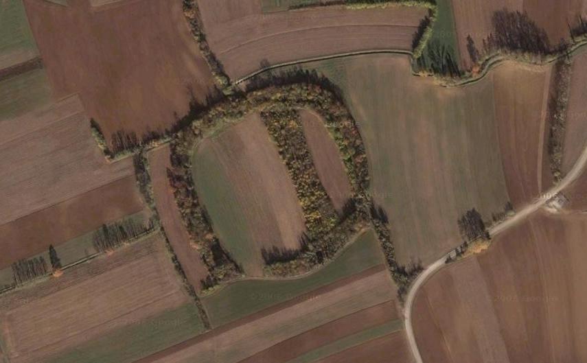
Castellieri are proto-historical sites (some of them dating back to 1800 b.C.) whose exact purpose has not been understood yet. They were most likely fortified inhabited structures during the Bronze Age. There are several of them in the area between Udine and Codroipo and some examples are found also in the neighboring Veneto region, but also in Istria. The photo to the left (GoogleEarth; North is on the top and East to the right) shows the case of Savalons, where the quadrangular structure has a side of about 200 meters. The perimeter of the castelliere is made up by an earth embankment, with an elevation that varies between 2 and 5 meters. The total volume of material is larger than ten thousand cubic meters. A preliminary study by A. Aveni and G. Romano has suggested that these sites might have astronomically significant orientations. |
|
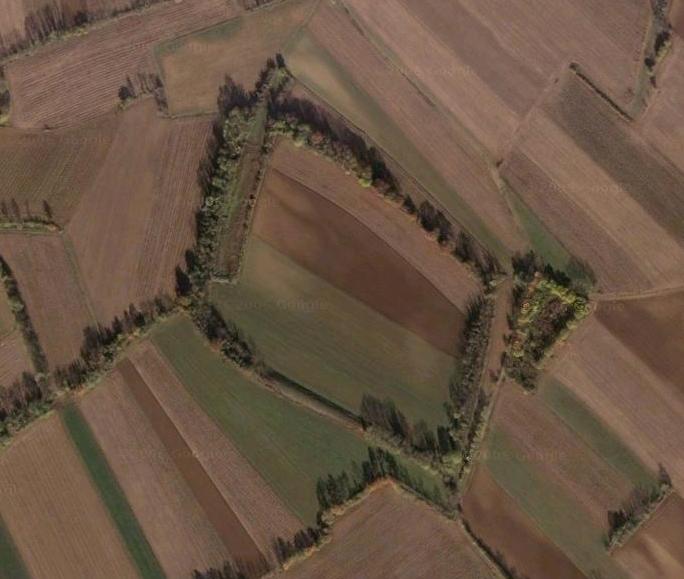
Another nice example is presented in the right picture (GoogleEarth),
which shows the castelliere of Galleriano.
Dr. Susi Corazza, Laboratory of Proto-History of the University of Udine, has been working quite a bit on these archaeological sites, with very interesting findings (here is a list of the excavations run by the Udine University under the direction of Prof. P. Cassola-Guida). Given the renewed interest on these enigmatic sites and stimulated by the pioneering work by Aveni and Romano, we have started a collaboration, that involves also some volunteers from the Friulian Association for Astronomy and Meteorology (AFAM), with the aim of studying Friulian castellieri from an archaeoastronomical point of view. |
|
|
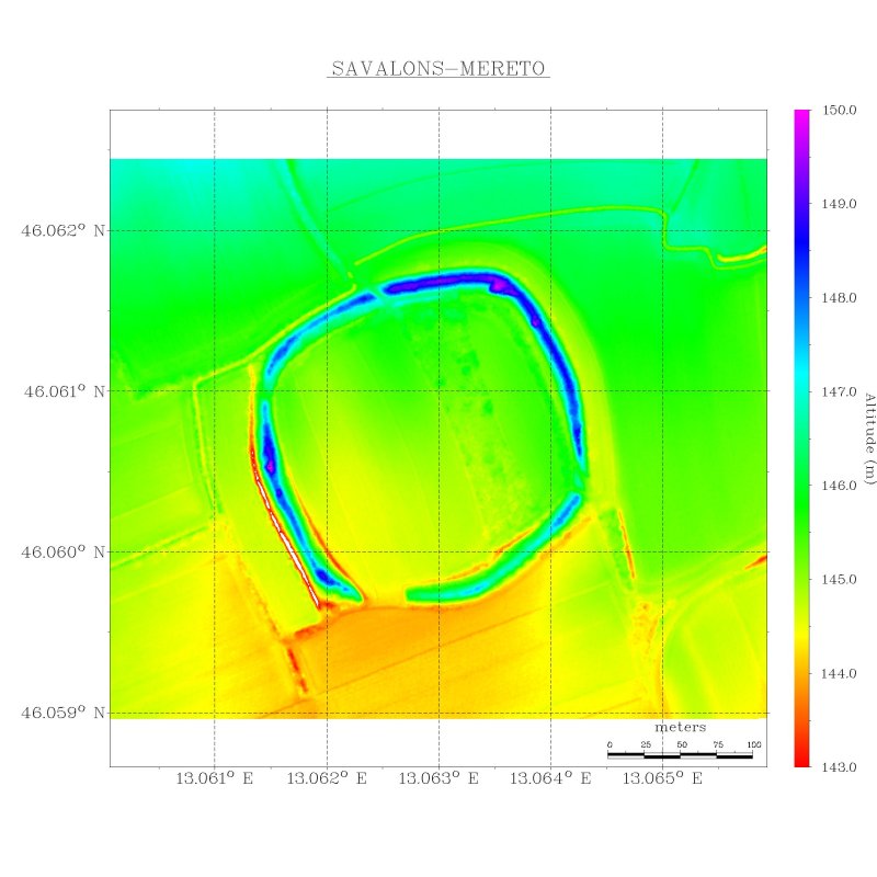
| The laser-scan data obtained by HELICA (Nov 2007) for the Savalons site (rendering by the author). Coordinates are in the WGS84 reference system. |
|
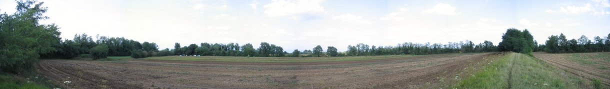
| A panoramic composite picture of the castelliere of Galleriano seen from the southern corner. The small plateau visible on the left is the so called "Roman field" (August 2007. Photo by the author). |